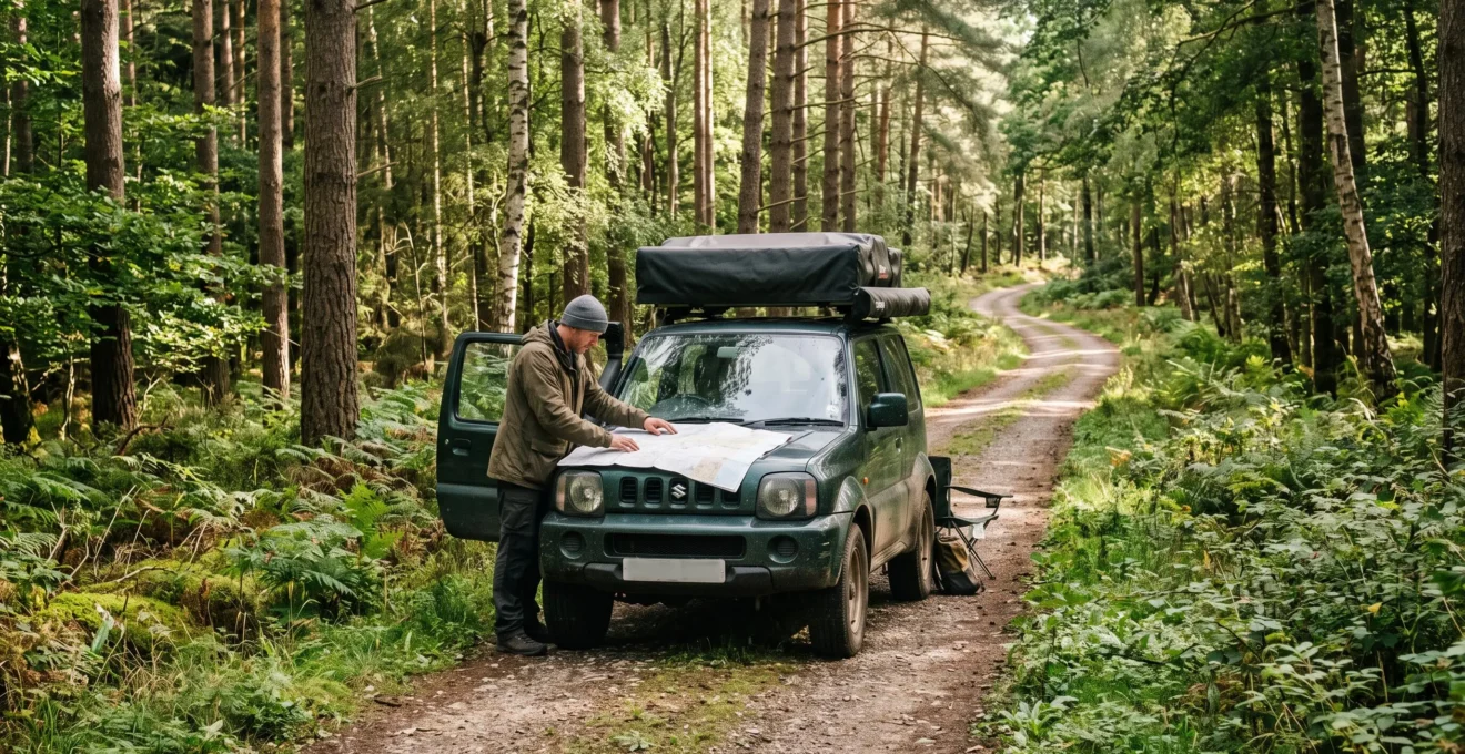
Driving through woodland without damaging it starts long before the wheels reach the first forest junction. A track may appear accessible but carry no public motor vehicle rights. A dry gravel road can become vulnerable after rainfall, while a route that looks straightforward on a phone may be difficult to follow beneath dense tree cover.
The safest approach combines three disciplines: verify access, minimise ground disturbance and prepare to navigate independently of live electronic guidance. Each decision affects the next. Choosing an unsuitable route increases the likelihood of getting stuck, widening muddy sections, reversing into vegetation or entering sensitive habitats.
Responsible forest driving is not about testing how far a vehicle can travel. It is about knowing which routes are permitted, recognising when conditions exceed the vehicle or driver’s capabilities, and reaching an authorised camping destination without leaving avoidable damage. The principles apply across English-speaking destinations, although access laws and land-management requirements must always be checked locally.
Forest driving essentials
- Confirm motor vehicle access through official route records and current closure notices before entering woodland.
- Stay on designated, established surfaces and avoid wet ground, wheel spin and unnecessary turning.
- Carry offline maps, a paper map, compass and written route notes, with a legal exit planned in advance.
- How to Identify Legal Forest Tracks Versus Closed or Restricted Routes?
- What Speed Should You Drive on Forest Tracks to Avoid Damaging Vegetation?
- Should You Continue When Forest Tracks Become Muddy and Rutted?
- How to Navigate Dense Forest Tracks When GPS Signal Fails Under Canopy?
- Why Should You Reverse Your Exit Route Rather Than Find Turning Points in Forests?
- The Treading Mistake That Damages 200-Year-Old Tree Roots in Ancient Woodlands?
- How to Explore Woodland Areas Using Natural Landmarks Instead of Technology?
- How to Experience Ancient Woodland Sites Respectfully During Camping Visits?
How to Identify Legal Forest Tracks Versus Closed or Restricted Routes?
A forest track is legal to drive only when applicable access rights or landowner authorisation permit your vehicle and journey, and no current restriction prevents entry. A worn surface, tyre marks or an open gate cannot establish those rights. Check official route designations and current notices before travelling, particularly where forestry operations, conservation or seasonal hazards affect access.
In England and Wales, public rights of way distinguish between different permitted users. Footpaths provide walking rights, bridleways generally permit walking, riding and cycling, and restricted byways do not confer public rights for mechanically propelled vehicles. Byways open to all traffic can carry motor vehicle rights, subject to applicable restrictions, although their surfaces may be unsuitable for ordinary vehicles.
The terminology matters because a track described casually as green lane has no automatic legal status. Devon County Council explains these distinctions in its official guidance on public rights of way. Drivers must still consult the appropriate highway authority’s records and applicable traffic restrictions for the individual route.
A permissive path depends on landowner permission, while an operational forestry road may exist primarily for timber extraction, maintenance or emergency access. Neither its construction nor its apparent suitability makes it available for recreational driving.
In U.S. National Forests, the U.S. Forest Service Motor Vehicle Use Map data service identifies designated routes, permitted vehicle classes and seasons of motorised use. This technical resource supports route verification but does not replace the applicable published Motor Vehicle Use Map or current local closure notices.
Before departure, verify the route against the responsible authority’s information and check for temporary restrictions associated with wildfire conditions, forestry work, wildlife protection or other management needs. In the UK, recreational green-lane information may help identify routes worth investigating, but it is not a substitute for authoritative legal records.
Physical barriers, signs, earth bunds and deliberate obstructions should prompt an immediate stop and further verification. Such features can indicate restricted access, but they do not independently determine a route’s legal classification. Overgrown vegetation may simply indicate infrequent use.
Never bypass a gate or barrier by driving onto adjoining ground. Doing so can damage habitat, interfere with land management and create potential legal consequences for the driver. Unauthorised driving may also prompt managers to introduce tighter access controls, although responsibility and enforcement outcomes vary by jurisdiction.
Once access is confirmed, the next question is not how quickly the vehicle can reach the campsite, but how little disturbance it can create along the way.
What Speed Should You Drive on Forest Tracks to Avoid Damaging Vegetation?
Drive at a low, controlled speed that allows the tyres to maintain traction without spinning, sliding or leaving the established track. There is no universal environmentally safe speed: surface condition, gradient, moisture, vehicle mass and visibility all matter. The objective is smooth progress with minimal ground disturbance, not maintaining a particular number on the speedometer.
On firm gravel, steady movement generally allows better anticipation of junctions, pedestrians and wildlife. On loose or damp surfaces, abrupt acceleration, braking and steering can displace material or cut into the track. The appropriate response is to reduce demands on tyre traction, and stop if progress requires damaging the surface.
Speed alone does not determine soil compaction. Vehicle weight, tyre loading, ground moisture and repeated traffic also matter. Compaction occurs when pressure reduces the pore spaces in soil, affecting water movement and root development. These changes can persist after visible tyre marks disappear.
That distinction is important: driving slowly across undisturbed woodland soil does not make the crossing environmentally acceptable. Remaining on the authorised hardened route is more protective than relying on low speed to compensate for travelling over sensitive ground.
Adjust driving behaviour by observing the vehicle’s contact with the track:
- Tyre behaviour: spinning, sideways slipping or deepening impressions indicate deteriorating traction.
- Surface response: gravel displacement, crumbling edges and developing ruts suggest increasing damage.
- Vegetation: branches, ferns or saplings brushing the vehicle may indicate that the route is too narrow for it.
- Visibility: bends, junctions and concealed approaches require enough control to stop within the visible clear distance.
- Other users: walkers, cyclists, horses and wildlife require additional separation and caution.
A suitable gear and gentle throttle inputs may help maintain traction on an appropriate surface. However, using additional power to force progress through vulnerable ground can cause damage even when the vehicle remains within the apparent track width.
Allowing more travel time also reduces the pressure to accelerate through obstacles or take shortcuts. Persistent erosion can increase maintenance requirements and contribute to route restrictions. Protecting the track therefore helps preserve legitimate future access.
Speed management has limits. When the soil becomes saturated or ruts deepen, deciding whether to proceed matters more than choosing another driving technique.
Should You Continue When Forest Tracks Become Muddy and Rutted?
Continue on a muddy forest track only if access remains permitted, the surface can support the vehicle without significant additional damage, and a safe exit is realistically achievable. Existing ruts are not automatic permission to proceed. If the ground is saturated, traction deteriorates or the only passable line crosses vegetation, stop and reconsider the route.
Muddy tracks are particularly vulnerable because wet soil deforms more easily under wheel loading. The environmental problem extends beyond individual tyre marks: once ruts become impassable, following drivers may move onto the verges, progressively widening the disturbed area.
The responsible recreation organisation Tread Lightly! recommends avoiding wet and muddy trails where possible and staying on designated surfaces. Its T.R.E.A.D. Principles for responsible outdoor travel also caution against widening routes by driving around obstacles.
Before entering a muddy section, stop in a safe place and assess its condition without walking onto sensitive vegetation. Examine whether water conceals a firm base, whether ruts exceed the vehicle’s practical clearance, and whether the route ahead slopes towards wetter ground.
The distinction between shallow mud over a stable surface and waterlogged organic soil is especially important. Peat and other saturated substrates may be unable to support vehicle loading without substantial damage. Appearance alone cannot reliably establish bearing strength.
| Condition | Appropriate decision | Environmental concern |
|---|---|---|
| Shallow damp section with a stable established base | Assess whether careful passage is permitted and genuinely low impact | Surface displacement and repeated loading |
| Deepening ruts with uncertain depth | Stop and inspect before committing | Grounding, wheel spin and rut enlargement |
| Soft peat, saturated soil or vegetation needed for traction | Do not enter the section | Severe deformation and habitat damage |
| No verified safe exit or turning facility ahead | Withdraw while a safe established route remains available | Stranding and off-track recovery damage |
Where passage is both authorised and demonstrably suitable, smooth control within the existing established running surface avoids creating a new track line. However, remaining in deep ruts is not always safe or environmentally preferable. Stop if the wheels begin digging into the surface rather than advancing.
Do not respond to a blocked track by accelerating repeatedly, driving onto vegetation or attempting recovery manoeuvres that expand the disturbed area. If a safe, permitted withdrawal is impossible, arrange appropriate assistance rather than improvising an off-track escape.
The useful rule is to turn back before conditions become irreversible, not after the vehicle is already stranded. Waiting for conditions to improve can sometimes help, but only where stopping is safe and authorised and the ground can genuinely recover.
A conservative route decision also protects navigation confidence: turning around at a known junction is easier than trying to find an exit while stuck in deteriorating conditions.
How to Navigate Dense Forest Tracks When GPS Signal Fails Under Canopy?
Navigate dense woodland with several independent layers: a downloaded offline map, a suitable paper map, a compass and written junction instructions. Set important waypoints and study the return route before entering the forest. Tree cover can reduce satellite positioning reliability, while cellular coverage may be absent, so navigation should never depend entirely on a live connection.
Satellite positioning and mobile connectivity are separate systems. GPS and other satellite navigation receivers depend on signals from satellites, which may be weakened or obstructed by dense vegetation and surrounding terrain. Mobile network coverage affects online maps, messaging and downloading route information, but an offline navigation app may still calculate position without cellular data when satellite reception is sufficient.
This distinction explains why downloading a map is necessary but not sufficient. Offline map tiles can remain visible while the displayed position becomes inaccurate or unavailable.
Before leaving reliable connectivity, download coverage for the complete outward and return journey, including nearby permitted alternatives. Check the map’s scale, route classifications and offline availability. Mark the entrance, confirmed junctions, suitable stopping areas and planned exit.
On the paper map, trace the route and annotate junction order, approximate distances, slopes, stream crossings and distinctive clearings. Write the sequence separately so it survives the loss or failure of the electronic device.
A junction described as “second left after the stream crossing, before the uphill bend” is easier to recognise than an isolated coordinate when positioning becomes unreliable. Such descriptions must come from verified mapping and observations, not assumptions about what the forest might contain.
Five preparations for navigating a forest track without live GPS
- Verify route access: record the official map or authority used to confirm each motorised section, producing a route-access record.
- Prepare offline coverage: download and open the entire route while disconnected from mobile data, producing a tested offline map.
- Mark the paper route: identify entrances, junctions, terrain features and authorised exits, producing an annotated physical map.
- Write junction instructions: list direction changes and distinguishing features in travel order, producing a waterproof route card.
- Confirm emergency arrangements: check device power, communication limitations and the planned response to navigation uncertainty, producing a simple contingency note.
While driving, compare each junction with the route card. Note elapsed time, approximate distance and changes in direction. A compass helps maintain general orientation, but does not establish whether a particular road is legally accessible.
Battery failure introduces a separate risk. Carry suitable charging equipment, but do not treat it as a replacement for independent navigation materials. Paper maps and written notes remain usable when a phone, tablet or vehicle display fails.
When an expected landmark or junction does not appear, stop safely rather than choosing the most plausible-looking branch. Reconcile the map, the terrain and the last confirmed position before continuing.
Knowing exactly where to travel is only part of the challenge. Drivers must also know whether the route allows a safe return without damaging vegetation during a hurried turnaround.
Why Should You Reverse Your Exit Route Rather Than Find Turning Points in Forests?
Reversing along an established forest track can avoid the verge damage caused by turning across vegetation, but it is not automatically the safest choice. A verified, sufficiently wide turning area is often preferable. Plan the exit before entering a narrow spur, and reverse only when visibility, vehicle control and surrounding terrain make the manoeuvre safe.
Many forestry tracks are narrow because they were constructed for specific management purposes rather than continuous recreational traffic. A route may terminate at a gate, worksite, drainage structure or dead end with no suitable turning area.
A multi-point turn on a narrow track can concentrate tyre pressure at its edges. Steering repeatedly on soft ground may disturb soil, crush plants or contact young trees. Moving off the track to complete a turn can substantially increase the affected area.
The better solution is to identify legitimate manoeuvring space before committing. Wide junctions, purpose-built passing places and established turning bays may offer suitable options, provided their use is authorised and they are not needed for forestry operations or emergency access.
Forestry stacks and timber-loading areas should not be assumed to be safe parking or turning places. They may contain operational hazards or be reserved for working vehicles.
If reversing is necessary, assess the return path before beginning:
- Identify ditches, steep edges, unstable shoulders and other obstructions.
- Check for pedestrians, cyclists, animals and approaching vehicles.
- Use a competent spotter where appropriate, ensuring the spotter remains visible and away from the vehicle’s path.
- Reverse slowly in controlled sections, stopping whenever visibility or communication becomes uncertain.
- Never enter soft verges simply to shorten a difficult manoeuvre.
Walking an uncertain section first may help identify hazards where doing so is safe and permitted. However, a spotter cannot eliminate all reversing risks, and cameras or mirrors do not guarantee a clear path.
If the intended exit requires a long or hazardous reverse, reconsider whether the track should be entered at all. The safest decision may be to choose another authorised route before reaching the confined section.
Vehicle size also matters. A track suitable for a small utility vehicle may not accommodate a wider four-wheel-drive vehicle with camping equipment. The presence of earlier tyre marks does not prove adequate clearance.
Limiting manoeuvres protects track edges, but even apparently undisturbed ground beside a forest road can contain vulnerable roots. That risk becomes particularly significant around veteran trees.
The Treading Mistake That Damages 200-Year-Old Tree Roots in Ancient Woodlands?
The damaging mistake is repeatedly driving, parking or walking over vulnerable soil around old trees, particularly when the ground is soft or wet. Compaction reduces the pore spaces needed for water movement and healthy root function. The harm may be difficult to see immediately, and an established campsite or attractive patch of shade does not necessarily provide a safe surface.
Ancient woodland and ancient trees are not interchangeable terms. In England, Wales and Northern Ireland, ancient woodland generally refers to land continuously wooded since at least 1600; Scotland uses a historical reference of 1750. These dates describe woodland continuity, not the age of every tree standing there.
A woodland designated ancient may contain younger trees, while a veteran or 200-year-old tree can exist outside designated ancient woodland. Nevertheless, long-established woodland soils and mature root systems warrant particular care.
The Woodland Trust‘s explanation of woodland soils describes how compaction reduces spaces within soil that support water infiltration, soil organisms and root development. It also highlights the ecological importance of soils associated with long woodland continuity.
Roots do not stop at the trunk or neatly follow the visible canopy edge. Fine roots may extend well beyond the drip line, depending on species, soil and site conditions. Using the canopy spread as a precautionary visual reference can help avoid obvious root areas, but it does not define a guaranteed safe parking boundary.
For drivers, the practical rule is to park only where vehicles are permitted and the ground is already suitably hardened. Never create a parking space by driving onto moss, leaf litter, exposed roots or apparently unused ground beneath a veteran tree.
For campers, repeated footfall can also contribute to compaction. Concentrating activity on authorised, durable surfaces is preferable to spreading tents, chairs and equipment across sensitive vegetation.
Damage can accumulate through repeated visits. Each individual may leave only minor visible traces, yet a frequently used informal parking area can gradually lose vegetation and soil structure.
These effects matter because ancient woodland soils can support specialist fungi, plants and invertebrates associated with long-established ecological conditions. Protecting a tree therefore involves protecting the surrounding habitat, not just avoiding contact with its trunk.
Recognising these hidden ecological boundaries adds another layer to route-finding: natural features help with orientation, but they must also influence where movement and stopping are appropriate.
How to Explore Woodland Areas Using Natural Landmarks Instead of Technology?
Use natural landmarks by identifying a sequence of recognisable terrain features before travelling, then confirming them against a map as the journey progresses. Ridges, streams, clearings and slope changes can provide orientation when electronic positioning becomes unreliable. The method works best as a companion to verified maps and compass navigation, not as a substitute for knowing the legal route.
Forest navigation differs from navigation across open ground because tree cover shortens sightlines. A distant summit may disappear behind vegetation, while nearby junctions can appear deceptively similar.
Begin by selecting three to five features that are distinguishable on both the map and the terrain. These might include a stream crossing, a pronounced uphill section, a major track junction, an open clearing or a change in ridge direction.
Record the features in travel order, together with approximate intervals and expected direction changes. As each one appears, confirm it against the map rather than relying on recognition alone.
Some natural cues are more dependable than others:
- Ridge lines and valleys: useful for understanding overall terrain structure, although smaller features may be hidden by trees.
- Stream crossings and confluences: recognisable features when accurately represented on the map.
- Slope direction: a useful supporting clue when comparing the route with mapped contours.
- Distinctive veteran trees: potentially memorable, but difficult to identify confidently among similar woodland features.
- Clearings: useful orientation points whose appearance may change through vegetation growth or forestry activity.
Water flow can help establish which direction is downstream, particularly where the mapped drainage network is clear. However, flowing water does not inherently indicate north, south or the correct exit. It becomes useful only when interpreted alongside a reliable map.
Forestry compartment boundaries, numbered posts and junction geometry can provide additional references. Such infrastructure may change with management operations, so it should not replace more stable terrain information or current route records.
On the outward journey, note the direction of each junction as well as how it will appear on the return. A fork that is obvious when entering may look different from the opposite direction.
Maintaining a brief written log of elapsed time, route changes and confirmed landmarks makes the return route easier to reconstruct. It also helps identify discrepancies before they develop into navigational uncertainty.
There is a direct ecological benefit: confident navigation reduces unnecessary exploratory driving, repeated turns and accidental movement onto unsuitable branches. It is generally better to stop at a safe established point and resolve uncertainty than to continue moving in the hope that the route becomes familiar.
These habits are particularly valuable when visiting ancient woodland, where even small deviations from permitted access areas can affect sensitive habitats.
Key takeaways before visiting ancient woodland
- Choose an authorised campsite or parking location before planning the woodland visit; proximity does not create access rights.
- Treat undisturbed woodland soil, root areas and deadwood as habitat rather than convenient space for camping activities.
- Make access verification, terrain awareness and a planned exit part of the same low-impact journey.
How to Experience Ancient Woodland Sites Respectfully During Camping Visits?
Experience ancient woodland responsibly by using authorised access routes and arranging camping on land where overnight stays and vehicle use are expressly permitted. Keep tents and vehicles away from sensitive root zones, leave deadwood undisturbed, minimise wildlife disturbance and remove waste. The objective is to enjoy the woodland without treating its ecological features as camping infrastructure.
Many ancient woodland sites are privately owned, actively managed or protected for conservation. Public access, where available, does not automatically permit driving, overnight parking, tent pitching or fires.
Rules differ substantially between countries and even neighbouring properties. In England, public rights of way may allow passage without granting camping rights. In the United States, camping opportunities depend on the managing authority, land designation and current local restrictions.
For that reason, a legal campsite near an ancient woodland may be a more suitable base than attempting to bring a vehicle into the site itself. Confirm the permitted parking and walking approach with the relevant land manager.
Once at the campsite, use a consistent conduct framework:
- Protect root zones: remain on authorised pitches and hardened surfaces, avoiding undisturbed soil around mature trees.
- Leave deadwood in place: fallen branches, decaying timber and standing dead trees can provide habitat for fungi, insects and other wildlife.
- Limit noise and artificial light: avoid unnecessary disturbance, especially during periods of nocturnal wildlife activity.
- Handle waste responsibly: carry out litter and use authorised sanitation and wastewater facilities rather than disposing of grey water in woodland.
- Respect fire restrictions: avoid collecting woodland fuel and use fires or cooking equipment only where explicitly permitted.
- Stay within permitted areas: do not create informal vehicle access, parking spaces or routes between established tracks.
The ecological value of ancient woodland is not limited to its oldest trees. Long continuity can support distinctive soil communities, fungi, invertebrates and woodland structures that cannot simply be recreated by planting young trees elsewhere.
Replanting may establish new woodland, but it does not immediately replace the habitat conditions associated with centuries of ecological development. That is why apparently small disturbances deserve greater attention in these environments.
Consider a hypothetical family journey to a woodland-adjacent campsite. The driver confirms the permitted access road, follows the established gravel surface and parks on the designated pitch. The family then visits the ancient woodland on authorised walking routes, leaving mossy ground, exposed roots and fallen branches undisturbed. This example illustrates how access planning and campsite behaviour reinforce each other without requiring an off-track driving adventure.
The same reasoning applies throughout the journey. Legal access prevents inappropriate entry; controlled driving reduces surface damage; reliable navigation limits unnecessary manoeuvres; and thoughtful campsite selection protects the ground surrounding vulnerable trees.
For the next woodland camping trip, mark a verified legal route, prepare independent navigation materials and select a designated camping area away from sensitive woodland soil. These preparations turn environmental restraint into practical decisions that can be followed from departure through the return journey.
Can a four-wheel-drive vehicle use any forest road that appears accessible?
No. Four-wheel-drive capability does not establish permission to use a route. Motor vehicle access depends on the applicable legal classification, landowner authorisation and current restrictions. A road built for forestry operations or showing existing tyre marks may still be closed to recreational vehicles.
Are offline maps enough for navigating remote woodland?
Offline maps reduce dependence on mobile data but do not guarantee accurate satellite positioning or continued device operation. Carry a suitable paper map, compass and written route instructions. Verify that the electronic map remains available without connectivity before entering remote areas.
Does lowering tyre pressure prevent damage to forest soil?
Tyre pressure can affect vehicle traction and the distribution of ground contact forces, but reducing it does not make sensitive soil safe to drive across. Vehicle loading, moisture, repeated passes and substrate condition remain important. Follow vehicle and tyre manufacturer guidance and stay on authorised, suitable surfaces rather than relying on a pressure adjustment to protect vegetation.
What should a driver do if a forest route is unexpectedly blocked?
Stop before the obstruction and assess the applicable access restrictions and available options. Do not drive around a barrier or onto vegetation. Use a verified existing turning area where safe, or carefully withdraw along the established route if conditions permit. Seek appropriate assistance if neither option is safe.
Can camping beside an ancient woodland still harm its ecosystem?
Yes. Camping activity can affect sensitive habitats through soil compaction, repeated footfall, waste, artificial lighting, noise and deadwood removal. Use authorised camping areas on suitable surfaces, respect any protective buffers and avoid treating nearby woodland as an extension of the campsite.