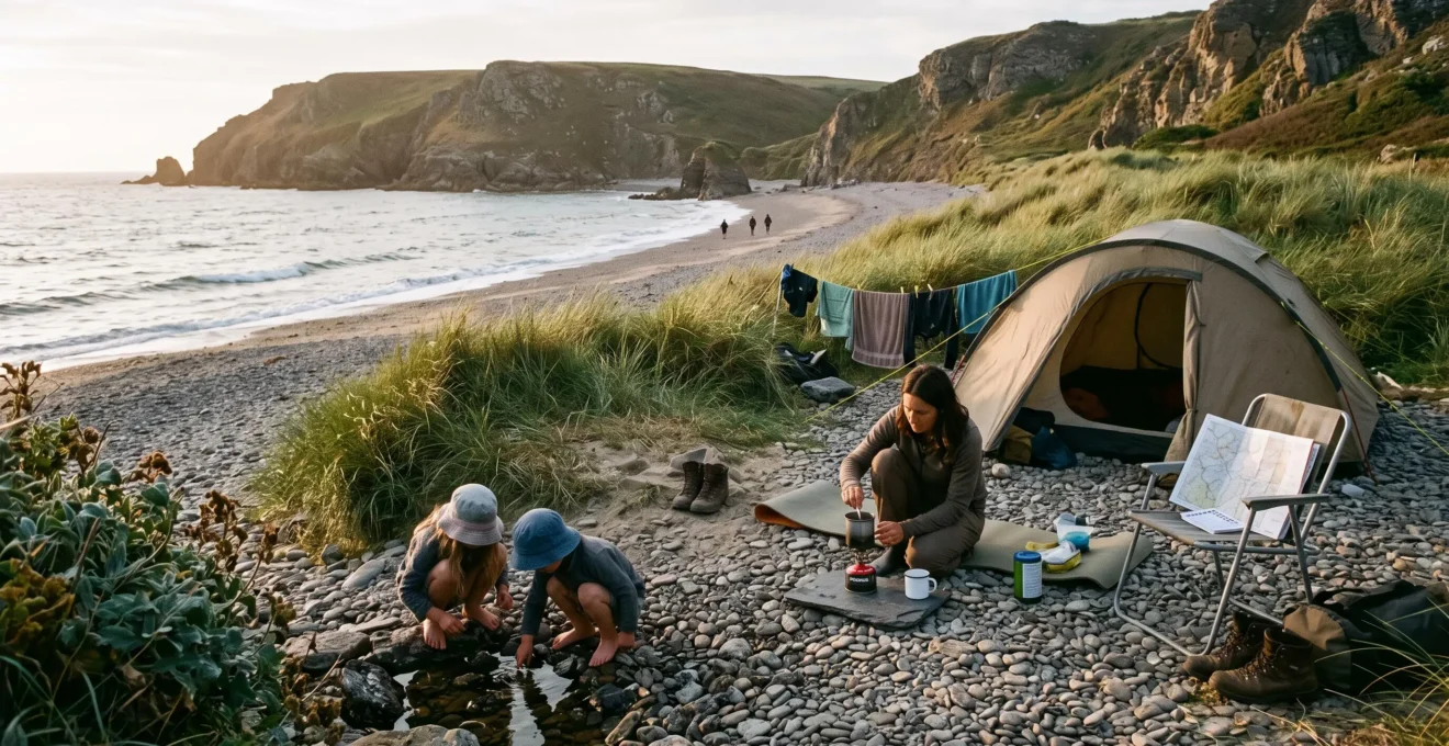
Finding an uncrowded beach near a campsite during peak summer is less about discovering a secret location than understanding why some stretches of coastline attract fewer visitors. Distance from parking, coastal terrain, legal access, tide conditions and nearby accommodation all influence whether a promising cove offers genuine solitude.
The most effective approach is to identify several candidate beaches before leaving the campsite, compare their accessibility and likely visitor pressure, and verify that each can be reached safely and legally. A sheltered beach requiring a manageable coastal walk may be a better choice than a famous bay reached directly from a large car park.
For families, privacy is only part of the decision. An empty beach without lifeguards, reliable communications or a safe route back may be suitable for a picnic but unsuitable for swimming. The following methods focus on British coastal mapping and access rules, with principles that can be adapted to other English-speaking destinations after checking local regulations.
Finding a quieter beach: the essentials
- Use detailed coastal maps, satellite imagery and walking routes to shortlist coves separated from busy access points.
- Check legal access, current path restrictions and tide times before travelling, particularly where headlands or cliffs limit escape routes.
- Investigate why a beach is quiet before entering the water; solitude is not evidence of safe swimming conditions.
- How to Find Hidden Beaches Using Ordnance Survey Maps and Terrain Analysis?
- The Legal Error That Gets Beach-Seekers Fined for Trespassing on Private Coastline?
- Should You Visit Secluded Beaches at Dawn or Dusk to Avoid Other Visitors?
- How to Check if a Beach Is Truly Secluded Before Driving 50 Miles to Visit?
- Why Is This Beautiful Beach Always Empty Even in Peak Summer?
- Blue Flag Beach or Wild Swimming Spot: Which for Families With Under-10s?
- How to Identify Legal Forest Tracks Versus Closed or Restricted Routes?
- How to Assess Natural Water Bodies for Safe Family Swimming?
How to Find Hidden Beaches Using Ordnance Survey Maps and Terrain Analysis?
Ordnance Survey maps can reveal quieter coastal coves by showing footpaths, contour lines, headlands and the distance between a beach and its nearest public access point. Look for beaches reached by established walking routes rather than roadside parking, then compare terrain, satellite imagery and tide information. A promising map location still requires checks for current access restrictions and usable shoreline.
Begin with a detailed Ordnance Survey map of the coastline around your campsite. Identify small bays between headlands, then trace the available public paths back to roads, settlements and parking areas. A cove with no direct vehicle access may attract fewer casual visitors, although a popular coastal walking route can still bring substantial footfall.
Contour lines help reveal access difficulty. Closely spaced contours indicate steep ground; wider spacing generally indicates gentler slopes. A short path descending sharply towards a cove may be less practical than a longer route following gradual terrain, especially when carrying beach equipment or walking with children.
Compare potential locations using a simple measure of access friction: the combination of walking distance, gradient, path condition and distance from visitor facilities. A moderate walk along a clearly marked public path may offer an attractive balance between privacy and practicality. An exposed scramble or unstable cliff descent should not be treated as a desirable shortcut simply because it discourages crowds.
Next, inspect satellite imagery to see whether the cove appears sandy, shingly or rocky. Check coastal walking guides for photographs and descriptions of the approach. Satellite images capture only one moment, so they cannot establish how much beach remains exposed at high tide. Tide tables and local coastal information are essential where the shoreline narrows beneath cliffs.
Finally, verify current conditions through relevant national park notices, local authority updates or recent community reports. Coastal erosion, landslips and temporary closures can make an otherwise accurate map unsuitable for planning today’s walk.
A map can identify a promising quiet cove, but it cannot grant permission to cross the land leading to it. Legal access is the next essential check.
The Legal Error That Gets Beach-Seekers Fined for Trespassing on Private Coastline?
The critical legal mistake is assuming that a beach’s proximity to a public coastal path gives visitors unrestricted permission to cross surrounding private land. In England, statutory coastal access rights apply only where the relevant legal conditions are met, and excluded land or local restrictions may interrupt access. Ordinary civil trespass does not automatically carry a fine, but entering restricted land can still cause disputes or legal consequences.
Three concepts need separating: the public right to follow a recognised path, ownership of the foreshore, and the right to enter land around the path. They are not interchangeable. A shoreline may be visible from a public trail without having a lawful route across the field, garden or private track between them.
Under England’s coastal access arrangements, the King Charles III England Coast Path is accompanied in applicable locations by coastal margin, including certain land seaward of the trail. However, this does not make every part of the margin accessible. Buildings, private gardens and other categories of excepted land remain outside statutory access rights, while additional restrictions can apply.
Natural England’s guidance on coastal access rights explains these distinctions and directs users towards official access maps. The guidance also establishes that camping and driving motor vehicles are not generally permitted merely because coastal access rights exist.
Do not confuse a trespass dispute with an automatic monetary penalty. In England, ordinary trespass is generally a civil matter. Particular restrictions, separate offences or breaches of court orders can have different consequences, but no universal fine applies simply because someone steps onto privately owned coastal land.
Regional differences matter. England’s coastal access system should not be assumed to apply unchanged in Wales, Northern Ireland or Scotland. Scotland has broader statutory responsible-access arrangements, but those rights also have exclusions and conditions. Outside the UK, consult the relevant jurisdiction’s coastal access rules.
Five checks before walking to an unfamiliar cove
- Mark the intended coastal access point on your map and save its grid reference or coordinates.
- Trace the complete approach along recognised paths and record any section where legal access remains uncertain.
- Check the relevant official access map and save the restriction information for the location.
- Review current closure notices and identify a lawful alternative route or destination.
- Save an offline route showing your starting point, permitted access, return path and planned exit before the tide changes.
On the ground, follow official notices and do not assume that a locked gate or prohibition sign can be disregarded. Conversely, a privately displayed sign does not necessarily extinguish an existing public right of way. If signs conflict with mapped rights, seek clarification from the responsible access authority rather than forcing entry.
Once a lawful route is established, the next question is when to visit. A quiet beach can become inaccessible as the tide rises, regardless of how few people are there.
Should You Visit Secluded Beaches at Dawn or Dusk to Avoid Other Visitors?
Both dawn and dusk can offer quieter beach visits, but neither is automatically the better choice. The safest and most practical time depends on the tide, available daylight, walking route, campsite distance and intended activities. Choose a suitable tidal window first, then use early or late daylight to reduce potential encounters with other visitors.
Dawn often works well for campers comfortable with an early start. Beaches may be quieter before daytime visitors arrive, and the return journey can take place in increasing daylight. However, a steep or poorly maintained approach can be difficult to navigate before sunrise, especially with children.
Dusk offers the appeal of an evening shoreline walk after a busy sightseeing day. Yet falling light reduces the time available to recognise hazards and return along coastal paths. For families with children under ten, a dusk excursion is generally easier when the beach is close to the campsite and the route is straightforward.
The tide table should determine the visit window. A secluded beach that looks expansive at low water may offer little usable space as the tide rises. Check local tide predictions, coastal warnings and the time needed to return. Avoid routes that depend on crossing a beach which can become cut off by the incoming tide.
Beach orientation also matters. A west-facing cove may retain direct evening sunlight, while surrounding cliffs can shade another beach well before sunset. Check the actual sunset time and allow enough daylight for the complete return walk rather than planning to leave the sand at sunset.
For swimming, consider water temperature, wind, swell and the presence of lifeguards. Early morning conditions may differ from those later in the day, but the time alone does not establish safety. Families should prioritise supervised swimming during patrol hours instead of treating an empty dawn beach as an inherently safer environment.
A useful alternative is the shoulder-day strategy: choose a weekday or a less popular weather window rather than competing with peak weekend demand. This may reduce visitor pressure without requiring a low-light journey, although results depend on local holiday schedules and weather.
Even excellent timing cannot compensate for a beach that has become a popular summer destination. Remote crowd checks can help avoid an unnecessary drive.
How to Check if a Beach Is Truly Secluded Before Driving 50 Miles to Visit?
Before making a long journey, assess three indicators of likely beach traffic: parking capacity, recent visitor reports and nearby holiday accommodation. Satellite imagery helps reveal access infrastructure, while dated reviews and photographs show whether a once-quiet cove has become more widely known. None guarantees solitude, so keep an alternative destination ready.
Start with the nearest car parks. A beach served by a large dedicated parking area, toilets and direct road access is likely to be more convenient for day visitors than one requiring a substantial walk. This is a screening clue, not a measured visitor count: small parking areas can still fill quickly, and some beaches receive visitors on foot or by public transport.
Next, search recent photographs and visitor comments on mapping platforms, walking guides and family-trip websites. Pay particular attention to comments about crowded access paths, parking queues and busy summer afternoons.
Review dates matter more than the total number of reviews. An enthusiastic description from several years ago may no longer reflect present conditions. Recent photographs and comments from comparable holiday periods are more useful than an undated claim that a beach is a hidden gem.
Examine the wider accommodation landscape. Large campsites, caravan parks, holiday-let clusters and coastal towns can increase the pool of potential visitors. Their presence does not prove that a particular beach will be busy, but it provides another reason to investigate recent local reports.
Consider the following hypothetical comparison. Cove A has direct parking, a nearby holiday park and several recent comments describing crowded afternoons. Cove B requires a legal coastal walk, has limited visitor infrastructure and attracts fewer recent online mentions. Cove B is the more promising solitude candidate, provided its access and safety conditions are acceptable. Neither can be certified empty from these clues alone.
Finally, make the first visit part of a longer coastal walk or pair it with an established alternative beach. If the cove is unexpectedly busy, the journey can still include a worthwhile outdoor activity without encouraging entry onto restricted land.
A consistently empty beach deserves closer investigation for a different reason: its lack of visitors may reflect a hazard rather than successful concealment.
Why Is This Beautiful Beach Always Empty Even in Peak Summer?
A scenic beach may remain empty because it is difficult to reach, has little parking, lacks facilities or carries locally recognised hazards. Strong currents, exposed surf, unstable access paths and limited emergency assistance can all discourage visits. Before celebrating the solitude, establish whether the main obstacle is inconvenience or a condition that makes the beach unsuitable for your planned activities.
Some reasons are primarily practical. A long but manageable public footpath, lack of shops or limited parking can make a beach less appealing to casual visitors. For well-prepared campers seeking a quiet walk or picnic, those features may be acceptable.
Other explanations require caution. Dangerous currents, unpredictable waves, falling rocks, tidal cut-offs and difficult rescue access are not inconveniences to overcome in pursuit of privacy. A beautiful cove can be an excellent viewpoint while remaining unsuitable for swimming.
Use the following decision grid to separate solitude benefits from potential safety concerns.
| Possible reason | What to investigate | Practical response |
|---|---|---|
| Long coastal walk | Public access, gradient and return time | Consider visiting if the route suits everyone |
| Limited facilities | Water, toilets, shade and communications | Prepare supplies and an exit plan |
| Strong surf or currents | Local warnings and current conditions | Keep the visit land-based |
| Tidal cut-off | Tide times and safe return routes | Do not enter without a reliable exit window |
| Unstable cliffs or paths | Closure notices and geological hazards | Choose another beach |
Unsupervised beaches also present additional considerations. Mobile reception may be unreliable, emergency responders may face a long approach, and there may be nobody nearby to raise the alarm. Families should account for these conditions even when planning activities that do not involve entering the sea.
Social media popularity can change visitor patterns, so an obscure beach may not stay obscure. Keep two or three suitable alternatives rather than depending on a single location. Sharing responsible access and safety information is more valuable than treating hazardous access routes as secrets worth preserving.
For families, this distinction becomes especially important when deciding between a managed swimming beach and an isolated natural cove.
Blue Flag Beach or Wild Swimming Spot: Which for Families With Under-10s?
For families with children under ten, a suitable lifeguarded beach is generally the more prudent choice for swimming, while a secluded wild cove may be better for shoreline exploration. Blue Flag certification provides evidence of compliance with environmental, water-quality, safety and service criteria, but it does not guarantee lifeguards at every moment or eliminate changing sea hazards.
Blue Flag beaches are assessed under an international programme covering environmental management, bathing water quality, safety, services and related requirements. The Blue Flag’s official certification criteria explain the programme’s scope and the obligations applicable to participating sites.
Certification should not be confused with real-time permission to swim. Lifeguard schedules, beach flags, currents, tides and weather still require checking on the day. Equally, an uncertified beach is not automatically polluted or unsuitable for every form of recreation.
For families balancing privacy and predictable facilities, the differences are practical.
| Consideration | Blue Flag beach | Unmonitored wild cove |
|---|---|---|
| Water quality | Subject to certification requirements | May lack designated bathing-water monitoring |
| Lifeguards | Check actual patrol arrangements | Typically no organised supervision |
| Facilities | Services assessed under applicable criteria | Often limited or absent |
| Privacy | Varies with location and visiting time | Potentially quieter, not guaranteed |
| Swimming decision | Follow current conditions and patrol guidance | Do not assume water is safe without reliable local assessment |
A useful family compromise is to reserve a suitable lifeguarded beach for swimming and choose quieter coves for walking, photography, rock pooling or picnics. Shallow-looking water at an unmonitored cove can still contain currents, slippery rocks and sudden changes in depth; paddling also requires close supervision.
For water quality in England, the Environment Agency’s Swimfo bathing water service provides classifications and pollution information for designated bathing waters. Its annual classifications reflect monitoring over time, and some locations also have pollution risk forecasts. An unlisted cove should not be assumed clean merely because no warning appears.
Where a remote beach has no reliable water-quality information or rescue cover, choose land-based activities rather than interpreting uncertainty as reassurance.
Before reaching either type of beach, campers may encounter another access complication: forest tracks that look drivable on maps but are not open to ordinary vehicles.
How to Identify Legal Forest Tracks Versus Closed or Restricted Routes?
A forest track shown on a map is not necessarily a road that campers may legally drive. Establish access by checking the route’s recorded rights, current forestry or park authority notices, and signs at the entrance. Walking, cycling and motor vehicle permissions can differ, while temporary closures may affect otherwise accessible routes during forestry operations or other safety restrictions.
Ordnance Survey mapping is a useful starting point because it distinguishes several categories of paths and rights of way. However, the appearance of a broad track does not establish a public vehicular right. A forest road maintained for forestry equipment may be physically passable while remaining closed to visitors’ cars.
Separate physical access from legal access. A gate standing open, a visible tyre track or a route suggested by navigation software is not sufficient proof that driving is permitted. Check authoritative rights-of-way information and any restrictions applying to the land.
Next, look for current operational notices from the relevant forestry service, national park or land manager. In England, Forestry England manages sites where forestry operations and other restrictions can affect visitor access. Felling activity, fire-related restrictions and temporary closures should be checked shortly before departure, rather than relying on a map saved earlier in the season.
On arrival, observe entrance notices, barriers and directional signs. Where information conflicts, do not drive beyond a restriction while attempting to resolve it. Use an established public parking area and continue only along a route legally available for the intended mode of travel.
These checks matter particularly when a coastal campsite sits near woodland separating the main road from an undeveloped shoreline. A track that looks like a convenient shortcut may lead to a private forestry road rather than an authorised beach access point.
Plan the final approach from the nearest confirmed legal parking location. If the remaining walk is unsuitable for children or equipment, choose another cove instead of attempting unauthorised vehicle access.
After resolving access and timing, one final decision remains: whether conditions at the water’s edge justify swimming or call for a safer alternative activity.
Before anyone enters the water
- A legal route and an uncrowded shoreline establish access and privacy, not swimming safety.
- Current sea conditions, reliable exits and available rescue assistance matter more than how calm the beach looked in photographs.
- Families should be prepared to switch from swimming to a shore-based visit whenever important safety information is missing.
How to Assess Natural Water Bodies for Safe Family Swimming?
Assess an unfamiliar beach by checking current warnings, lifeguard coverage, tide movements, waves, wind, water quality and safe entry and exit points before considering swimming. For children, choose a suitable lifeguarded beach whenever possible. A visual shoreline inspection can identify obvious hazards, but it cannot reliably rule out hidden currents, sudden depth changes or other underwater dangers.
Begin the assessment before leaving the campsite. Check weather and tide forecasts, local warnings and available water-quality information. On arrival, compare those expectations with the conditions actually present. Stronger-than-expected surf, deteriorating visibility or an unsafe return route are reasons to abandon the swimming plan.
Rip currents deserve particular attention. Possible indicators include a channel of unusually choppy water, foam or debris moving away from shore, or a gap in breaking waves. These signs are not always visible, and apparently calm water between breaking waves can still be dangerous. Do not treat the absence of visible signs as proof that a beach is free from rip currents.
The Royal National Lifeboat Institution recommends choosing lifeguarded beaches and swimming between red-and-yellow flags. Its RNLI beach safety advice also explains common hazards including rip currents, tides and cold-water shock. A red flag indicates that entering the water is unsafe.
At an unfamiliar shoreline, identify the available exits, slippery rocks, changes in depth and any areas exposed to breaking waves. Conditions can change during a single visit as the tide rises, wind shifts or swell increases. Reassess whenever the environment changes rather than relying on an earlier observation.
Cold-water shock is a serious consideration even on a warm summer day. Sudden immersion can disrupt breathing and swimming ability. Signs of distress, uncontrolled breathing, unusual weakness or difficulty staying afloat require immediate action and appropriate emergency assistance.
Other reasons to stop or avoid entering the water include jellyfish, suspected weever fish hazards, uncertain water quality, deteriorating weather and inadequate supervision. Keep a charged phone, know the emergency contact arrangements for the location and make sure the return route remains available.
When several adults are present, designate someone to maintain continuous attention on children near the water and rotate that responsibility explicitly. Adult supervision does not replace lifeguards, and a remote beach should never be considered safe solely because a family member is watching.
The best next step is to choose one legally accessible beach for a quiet shoreline visit and a separate, appropriately supervised beach for swimming if necessary. Solitude is worth seeking, but not at the expense of a reliable route home or a safe day by the sea.
How far should a campsite be from a secluded beach?
There is no universal ideal distance. Consider the complete journey, including legal parking, walking time, terrain, equipment and tide-dependent return access. A nearby cove reached by a manageable public footpath may be more useful than a remote beach requiring a difficult drive and descent.
Can you camp overnight on a secluded beach in England?
Coastal access rights do not generally include permission to camp. Beach ownership, local restrictions and separate landowner permissions may affect whether overnight camping is lawful. Use an authorised campsite unless you have verified permission for the exact location.
Can satellite imagery show whether a beach will be accessible at high tide?
No. Satellite imagery shows the shoreline at the time the image was captured, not across the full tidal cycle. Compare it with current local tide predictions, coastal maps and reliable access information, especially where cliffs or headlands restrict escape routes.
Is a beach safe for swimming if the water looks clear?
No. Clear water does not establish microbiological quality or rule out rip currents, cold-water shock and underwater hazards. Check official bathing-water information where available, follow local warnings and prefer lifeguarded swimming areas.
What should you do if your chosen hidden beach is crowded or inaccessible?
Use a preselected alternative with verified legal access and a suitable return route. Do not bypass closures, cross private land without permission or attempt a dangerous descent to preserve the original plan. A coastal walk or supervised beach visit can still provide a worthwhile day outdoors.